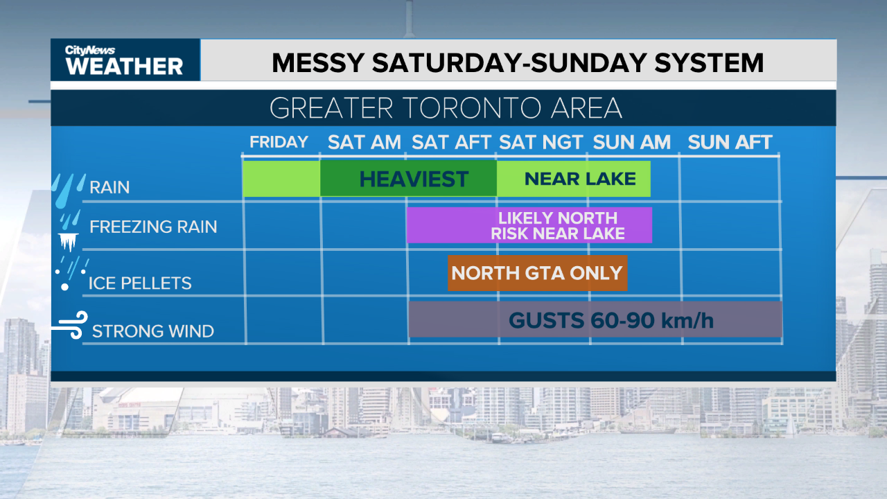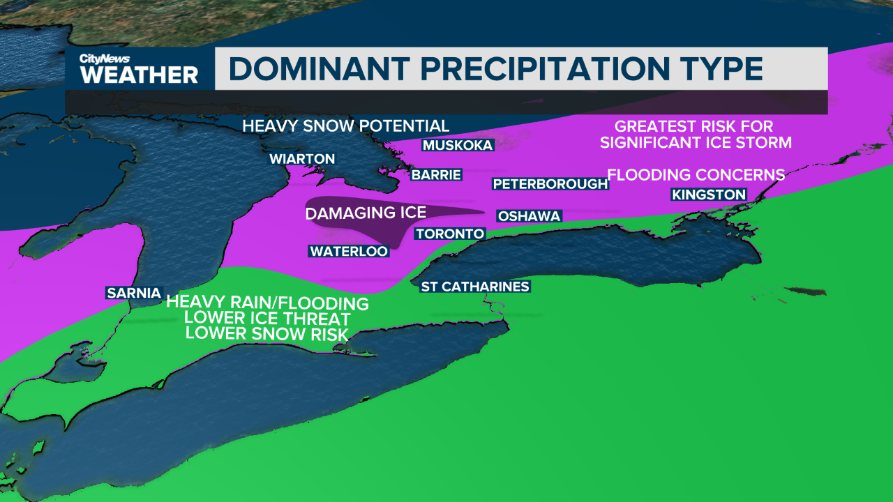
Significant winter weather is on the way and we will see a few different types of it this weekend. While the forecast track still shows some room for variability, it looks like the greatest risk at this point is freezing rain. It may last for several hours and cause significant disruptions for parts of the GTA, but that is not the only concern. In addition to the freezing rain threat, heavy rain will lead to flooding issues in both urban areas and in our creeks and rivers. Warning and watches are expected to be issued later today for much of the regions.
The timing of the storm and most significant impacts will arrive later in the day on Saturday. Non-essential travel may want to be postponed due to the rapidly changing weather conditions.

Below is a snapshot of what we could be facing this weekend in the various areas around southern Ontario.

The heavy rain potential may lead to flooding in parts of the city. Flood outlooks and flood watches have been issued for the waterways around the area. We are expected nearly two winter-time months worth of precipitation. Forecasts are hinting at anywhere from 50-100 millimetres across southern Ontario this weekend. For context, January averages 51.8 millimetres of monthly total precipitation and February 47.7 millimetres.
Winds are also expected which, when combined with significant ice accretion on trees and hydro lines, could lead to widespread power outages that could last for several days. Wind gusts are expected reach a range of 60-90 km/h Saturday night into Sunday morning.
“As a forecaster, I can’t stress enough that this system still has a lot of variables and will likely play out differently than the forecast models are suggesting. The best thing you can do [is] prepare for the worst case scenario. Don’t necessarily expect it to be the worst case, but at least be prepared for it.”
– Meteorologist Adam Stiles
Having an emergency kit at the ready for events like this is strongly recommended. Below are some of the basic items should be in that kit.


