The spring feel is returning to the GTA on Wednesday with temperatures in the city staying well above the freezing mark for the next few days and no snow in the forecast for at least the rest of the month.
A high of 7 C is expected in Toronto on Wednesday and Thursday will be even warmer with a daytime high near 10 C. A brief cooldown on Friday into Saturday will be followed by an extended stretch of above seasonal warmth.
CityNews 680 weather specialist Denise Andreacchi says we may not hit double digit temperatures next week but Toronto will see consistent daytime highs in upper single digits.
“We’re about a month out from spring and it definitely reflects that in the forecast,” she says. “For the next couple of weeks we are going to trend above seasonal.”
Friday will see a high of 2 C in the morning before the brief arctic cooldown that is expected to peak early Saturday morning with the air feeling around -17 with the windchill.
Then it’s back to spring-like daytime highs of around 6 C for Sunday and Monday, with similar temperatures through the rest of next week.
The latest warmup continues a trend of a warmer-than-usual February for the city. Toronto has seen a mean temperature of -0.2 C (measured at Pearson Airport) so far this month, well below the -2.7 C historical average mean temperature for the month.
The GTA is also not expected to see any significant snowfall for the remainder of February, or early parts of March.
“Not to say that we won’t see any snow in March or April,” Andreacchi says. “They are transitional times of year and we typically have big temperature swings.”
At Pearson, 8.2 cm of snow has fallen in February so far — the typical total snowfall total for the month is 24 cm.
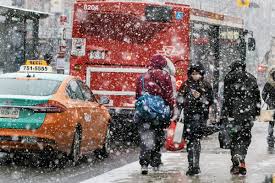
The return to warmer air follows a stretch of actual winter weather in the GTA. The city saw its first significant snowfall of the month last week and the region was briefly under a winter weather travel advisory over the Family day long weekend that saw bitter cold and strong gusting wind.


